Winter Storm Warning for Berkshires as Nor'easter Brings Up to Foot of SnowStaff Reports,
01:35PM / Sunday, January 16, 2022 | |
The Berkshires are in for a double whammy this week — a Nor'easter is expected to bring up to a foot of snow and ice overnight followed by another Arctic blast that will keep temperatures in the freezer zone.
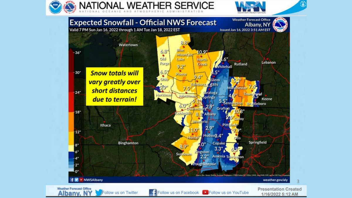
A winter storm warning is now in effect beginning Sunday at 10 p.m. and through Monday at the same time. The National Weather Service in Albany, N.Y., is forecasting 5 to 11 inches of snow and ice accumulations of up to a 10th of an inch. Winds could gust to 40 mph.
Adams, Clarksburg, North Adams (starting at 10 p.m.) and Pittsfield have so far declared snow emergencies and other communities may before the afternoon is over. Snow emergencies mean motor vehicles cannot be parked on the roadways during the storm to allow for plowing; in some communities public parking lots will be made available. Residents in North Adams needing assistance during the storm should contact Public Safety dispatch at 413-664-4945
The storm warning covers the Berkshires, eastern New York and northern Connecticut.
Snowfall rates of 1 to 2 inches per hour are possible between midnight and 7 a.m. The snow will later turn to a wintry mix of precipitation that could cut down the total accumulation of snow and create more hazardous conditions. The amount of snow will vary greatly depending on terrain.
Accuweather reported that lineman from Oregon were flying into Boston in preparation for the storm. The eastern part of the state is predicted to have damaging high winds and potential flooding. Eversource on Friday said it was prepositioning crews for both Sunday night's storm.
“We’ve been carefully monitoring these weather systems for the last few days and we’ll have workers and materials in position across the state ready to respond and will adjust our plans if the forecast changes,” said Eversource Vice President of Electric Field Operations in Massachusetts Bill Ritchie. “We’re fully stocked with extra utility poles, wire, transformers and other equipment and ready to repair any damage this storm may cause.”
National Grid tweeted on Sunday that it was "closely monitoring a storm expected to bring snow, rain & wind gusts of up to 55 miles per hour in MA & RI."
Monday is celebrated as Martin Luther King Jr. Day so schools and public offices will be closed.
Colder air will begin moving into the region Tuesday but Accuweather says the real blast will happen at the end of the week. The Midwest will get hit with lows in the minus-20s and the polar vortex will move into New England by Friday.
The jet stream will dip far south, leaving the Northeast in a deep chill through the end of January.
| 
 MEMBER SIGN IN